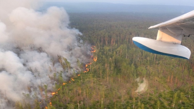
According to satellite data, smoke from wildfires burning across Russia’s biggest and coldest area reached the North Pole for the first time in recorded history last week, Moscow Times writes.
According to the European Union’s Copernicus satellite monitoring program, forest fires in the Siberian republic of Sakha (Yakutia), driven by hot weather and a 150-year drought, have already released a record 505 megatons of CO2 with many weeks left in the fire season.
“This week, wildfire smoke has reached more than 3,000 kilometers (1,864 miles) from Yakutia to the North Pole, a feat that looks to be a first in recorded history,” NASA’s Earth-monitoring tool MODIS stated Saturday.
Before reaching the North Pole, the dense smoke had blanketed huge swaths of Siberia, prompting evacuations, concerns about deteriorating air quality, and orders to remove fire tracks of dead wood and fallen trees surrounding threatened communities.
According to emergency personnel, smoke has been discovered in 1,300 towns and localities in the Krasnoyarsk area west of Sakha alone.
MODIS, or Moderate Resolution Imaging Spectroradiometer, said Friday that its satellite caught “just a small fraction” of the smoke that stretched 3,200 kilometers east to west and 4,000 kilometers north to south.
According to media accounts, the smoke has obscured the skies in places as far away as Mongolia, western Greenland, and Nunavut, Canada.
However, reaching the North Pole “is continental size by definition,” according to University of Maryland atmospheric scientist Santiago Gassó.
According to the EU’s Copernicus Atmosphere Monitoring Service, the Russian and North American wildfires will continue to spread across the Arctic Ocean “for the next few days.”
RELATED ARTICLES
ABOUT US
Eurasia News Now is an independent daily news website focused on key political, economic, and environmental issues in Eurasia, produced by journalists and subject-matter experts in the region and around the world.
Contact us: info@eurasianewsnow.com
Eurasia News Now©


